District 2 San Miguel


District II San Miguel
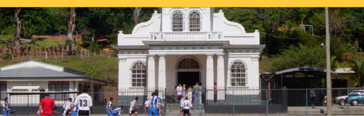
San Miguel: Villa
Area: 21,15 km2
Population (According to Census 2011): 31,805 inhabitants and 8,949 dwellings
Altitude: 1,230 meters above sea level.
Administrative Territorial Division
San Miguel*/. Towns: Angels, Fatima San Miguel District, Belarmina, Caribari, Cuba House, Israelite Ladies (Urb. Paz), Return, Sunflower, Garden, Schools, Meseguer, Orquideas, Peñascal, San José *, San Martín, Urb. Emperador, Urb. La Asunción, Urb. Las Américas, Urb. Los Manzanos, Urb. Villadolid.
Jericho*/. Towns: Alto Leona, Urb. Linda Vista.
Higuito * /. Towns: Altamira, Calle Manzanillo, Calle Naranjos, Calle Valverde, Gloria (West Side), Rodillal, Salitrillo, Santa Eduviges, Tablazo, Ticalpes (East), Trinidad, Urb. Agustín Jiménez, Urb. Santa Bárbara, Urb. Veracruz, Valverde.
Pacaya *.
The Plain. Towns: Roblar Street, Sabanilla Street, Rinconada (East Side), Urb. La Pradera Encantada.
Manzano (Manzanillo). Towns: Alto Alumbre, El Hoyo.
The hills*.
La Capri. Towns: Cola De Pavo, Olivos
Public institutions
- Dr. Rafael Calderón Muñoz School
- Agustín Segura School
- I.E.G.B. José María Zeledón Brenes
- El Manzano School
- Higuito School
- La Capri School
- La Pacaya School
- School Republic of Honduras
- Llano Bonito School, Sr. María Romero
- Edwin Porras School
- Lyceum of San Miguel
- Liceo de Higuito
- Marco Tulio Salazar Virtual College, San Miguel Headquarters
Historical review
School District). It was created at the initiative of the then Inspector of the School, Mr. Lucas Raúl Chacón and by agreement No. 980, dated June 2, 1913, which is read in Official Gazette No. 126; Says: "The President of the Republic, AGREES: To erect in District School, with the name of" Jericó "of" The Yerbabuena "and" El Hoyo ", of the district of Desamparados The new District is added to Circuit II of the Province Of San José, with the following boundaries: by the north and east courses, the limits of the district of San Miguel de Desamparados: to the south San Juan de Tobosi: North and to the West, the districts of the Rosary and Aserrí Publiquese, Jiménez. The Secretary of State in the Office of Public Instruction, Brenes Mesen ".
The new district is composed of the hamlets formed in the enclosures of the district of San Miguel and lands of "milpear" that previously were denominated La Rejoya.
They are sites of great fertility, highly cultivated, that constitute the granary of the district of San Miguel. The main neighbor, Don Agustín Segura, who was acclaimed as patron of the town; The premiere of the oratory was made on August 28, 1914.
SAN FELIPE
This is the name of the present district of San Miguel, as it is deduced by the limits that are assigned to said Barracks in the "Registry of boundaries and cairns that determine the quarters and neighborhoods of the department of San José in the year 1841"
HIGUITO
To the South of Two Fences and on the way to Candelaria, later, the cowboys stayed overnight under a leafy fig tree, whose branches offered good shelter and better shade, giving origin to establish families raised their houses in the neighborhood and the village was formed Which today is called Higuito knight of notable dimensions, who walked and was introduced by almost every corner where the great men travel. He distinguished himself as an editor, a work that complemented his work as a true creator.